Command Palette
Search for a command to run...
Google DeepMind Releases AlphaEarth Foundations, a World Map Generated on Demand for the First Time
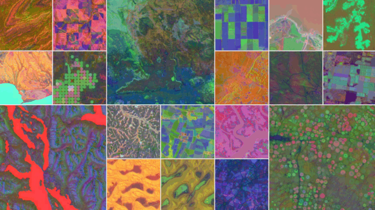
With the development of satellite technology, humans have been able to observe the Earth in near real time. However, although the massive, multimodal, and frequently updated remote sensing data is rich in information, it also brings new challenges - the data sources are scattered, the formats are different, and the usage is complex. How to integrate this scattered information into a consistent and usable perspective of the Earth has become a major challenge facing scientists and policymakers. Google DeepMind's latest release, AlphaEarth Foundations, officially responds to this challenge. This model can be regarded as a "virtual satellite".Integrating PB-level earth observation data,This innovative technology generates a digital Earth embedding that can be efficiently processed by computing systems. It provides an unprecedented global perspective on key issues such as agricultural monitoring, environmental protection, urban expansion, and water resource management.
* Paper link:
Highly compact data reduces storage space
The core innovation of AlphaEarth Foundations isIt solves two core problems of remote sensing data: one is information overload, and the other is data inconsistency.To this end, the model brings together information from dozens of public data sources, including optical satellite imagery, radar data, 3D laser scanning, climate simulations, etc., and integrates and analyzes these multi-source data to perform high-precision modeling of global land and coastal areas in units of 10 meters x 10 meters.
The system's core innovation lies in its ability to generate highly compact summaries for each square, which require only 1/16 of the storage space compared to other AI systems, greatly reducing the cost of planetary-level analysis.
In other words, this model has achieved "global map generation on demand" for the first time. Researchers do not need to wait for specific satellites to pass overhead or face traditional difficulties such as cloud cover. They can instantly obtain clear, structured, and coherent earth maps through the embedding vectors of AlphaEarth Foundations.
The performance is ahead of other models in all aspects
The working principle of AlphaEarth Foundations is shown in the figure below. The system indexes any point in time by extracting non-uniformly sampled frames from a video sequence. This helps the model construct a continuous view of the location while interpreting a large amount of measurement data.

To verify the performance of AlphaEarth Foundations, the research team conducted rigorous comparative tests. The experiments showed that the model performed well in different time periods and tasks, whether it was land use identification or surface attribute estimation. In particular, AlphaEarth Foundations still demonstrated excellent learning efficiency in the absence of labeled data.The average error rate is 24% lower than other models.
This advantage makes the system an irreplaceable tool for scientific research and public service. For example, in Ecuador, the model can penetrate perennial cloud cover to meticulously depict the development stages of different agricultural plots. In Antarctica, even in areas with extremely low satellite imaging frequency, the model can reliably restore surface structure. In Canada, it can depict differences in farmland use with details that even exceed those visible to the naked eye.

Each embedding contains 64 components, which correspond to coordinates on the 64-dimensional sphere
One of the largest AI Earth embedding datasets currently available
To promote wider adoption, Google has released the annual collection of embedding vectors generated by AlphaEarth Foundations on the Google Earth Engine platform as the "Satellite Embedding Dataset." This dataset covers over 1.4 trillion embedded points worldwide each year, making it one of the largest AI Earth embedding datasets available.
Over the past year, over 50 organizations, including academics, governments, and nonprofits, have piloted the dataset. The Global Ecosystems Atlas, a leading example, aims to create the first systematic classification resource for the world's ecosystems. Using AlphaEarth data, it successfully categorized previously unclassified ecological regions into categories such as "coastal shrubland" and "hyperarid desert," providing a scientific basis for countries to optimize their conservation and restoration efforts.
Nick Murray, director of the Global Ecology Laboratory at James Cook University, said: "This dataset is revolutionising our understanding of unmapped ecosystems and is crucial for prioritising protected areas."
In Brazil, the environmental organization MapBiomas is using the dataset to delve deeper into agricultural land use and environmental change, particularly in key ecological zones like the Amazon. Project founder Tasso Azevedo noted, "With this tool, we've made a quantum leap in mapping accuracy, speed, and coverage. We're now able to do things that were impossible before."
In the future, this technology may not only be used for static maps, but also drive real-time disaster warnings, climate change simulations, food security management and other global issues. Google also stated that they will continue to optimize the model and expand its dataset size and application boundaries.