Command Palette
Search for a command to run...
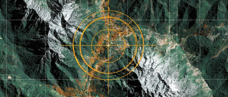
A Collection of Remote Sensing Target Detection Datasets, Covering Urban Issues, Industrial Safety, Agricultural Health, Indoor Scenarios, etc.
With the deep integration of artificial intelligence and remote sensing technology, remote sensing target detection is becoming one of the most dynamic research directions in the field of computer vision.Driven in particular by satellite imagery and drone aerial photography, object detection technology can not only identify people, vehicles, and buildings in natural scenes, but also enable precise detection of landslides and crops in complex geographical environments. It can be said that object detection provides us with a "machine eye" that can see into the world, enabling humanity for the first time to conduct a comprehensive and detailed observation of the Earth in near real time.
In terms of hardware, the sensor resolution of drones and remote sensing satellites is approaching the physical limit, but how to extract valuable target information from huge and complex data is increasingly dependent on efficient algorithm optimization.Remote sensing images often have characteristics such as large resolution differences, dramatic changes in target scale, and complex backgrounds. This means that the quality of the data directly determines whether the target detection model can move from "identifying presence or absence" to "precise positioning and multi-category classification."
The construction of datasets is the core of promoting the practical application of target detection. Compared with natural scene data,Remote sensing and target detection datasets have the characteristics of wide coverage and strong spatiotemporal dynamics, and can obtain large-scale, high-resolution geographic information in a short time.A scientific data collection process must rationally plan the regional scope and time window, and strictly control the division of training sets, validation sets, and test sets to ensure that the model has sufficient generalization capabilities.
In general, the current society's attention to high-quality object detection and remote sensing datasets is constantly increasing. To this end, HyperAI has compiled a number of datasets that are currently popular in academia and industry.It covers multiple fields including medical imaging, urban issues, indoor scenes, agricultural diseases, industrial safety, etc.These datasets are not only important tools for researchers and engineers, but also powerful engines for driving technology towards practical applications.
Click to view more open source datasets:
Summary of remote sensing target detection datasets
1. InteriorGS 3D Indoor Scene Dataset
Estimated size:19.84 GB
Download address:https://go.hyper.ai/eyG9q
InteriorGS is a 3D indoor scene dataset designed to overcome the limitations of existing indoor scene datasets in terms of geometric completeness, semantic annotation, and spatial interaction capabilities.
This dataset provides high-quality 3D Gaussian scattering (3DGS) representations, along with instance-level semantic bounding boxes and occupancy maps indicating the areas accessible to agents. The dataset includes 1,000 high-quality indoor scenes and their corresponding floor plans, covering over 80 environment types, including residences, convenience stores, wedding halls, and museums. Furthermore, it includes over 554,000 object instances across 755 object categories.
2. Landslide4Sense Landslide Remote Sensing Benchmark
Estimated size:2.84 GB
Download address:https://go.hyper.ai/mIdeN
Landslide4Sense is a multi-source satellite remote sensing benchmark dataset for landslide detection released by IARAI in 2022 and serves as the official dataset for the Landslide4Sense competition.
This dataset covers landslide scenes from multiple regions from 2015 to 2021. The dataset is organized into 128×128 image blocks with a resolution of approximately 10 m/pixel, and each sample contains 14 bands. The data is divided into training, validation, and test sets, with 3,799, 245, and 800 samples, respectively. The data also provides pixel-level binary masks (landslide = 1, non-landslide = 0). Only the training set has publicly available labels; the validation and test sets are used for ranking evaluation.
3. VisDrone drone detection dataset
Estimated size:2.1 GB
Download address:https://go.hyper.ai/Odzam
VisDrone is a large-scale drone visual target detection and tracking benchmark dataset released by the AISKYEYE team of Tianjin University. It aims to help develop and evaluate computer vision tasks such as target detection, object tracking and image segmentation.
This dataset contains high-resolution images and videos collected by drones in urban and suburban environments across various cities in China, covering six categories (such as people, vehicles, buildings, animals, etc.). The data was captured under different lighting conditions, angles, and motion patterns, and provides detailed image data and labels in YOLO format.
4. Crops Disease Crop Disease Dataset
Estimated size:1.99 GB
Download address:https://go.hyper.ai/exltg
Crops Disease is an agricultural crop disease image dataset designed to help develop computer vision models to automatically detect and classify diseases of different crops.
The dataset contains about 1,300 crop disease images, covering common diseases of various crops (such as corn, tomatoes, potatoes, etc.), and each image is labeled as a specific disease category.
Safety vest detection dataset
Estimated size:408.58 MB
Download address:https://go.hyper.ai/ahI1u
Safety Vests Detection is a safety vest detection dataset designed to benchmark new object detection architectures (YOLOv8, Faster-RCNN, SSD, etc.), transfer learning of related PPE detection tasks (helmets, gloves, goggles), and prototype development of edge-deployed safety monitors, helping to develop and train models to automatically identify and detect people wearing safety vests and improve workplace safety.
The dataset includes 3,897 high-resolution photos (showing workers with and without safety vests), bounding box annotations (Safety Vest and No Safety Vest), and image context (indoor workplaces, outdoor construction areas, different lighting conditions, occlusions, and multiple viewpoints).
6. HBFMID Human Fracture Image Dataset
Download address:https://go.hyper.ai/p7As2
This dataset is a medical imaging dataset released by the American International University Bangladesh in 2024, which aims to support fracture detection and classification tasks.
The dataset contains X-rays and MRI images of the elbow, fingers, forearm, humerus, shoulder, femur, tibia, knee, hip, wrist, spine, and selected healthy bones. The dataset initially collected 641 original images, divided into a training set of 449, a validation set of 128, and a test set of 64. All images were automatically oriented, resized (640×640), and contrast enhanced. Based on the training set, enhancement methods such as flipping, rotation, scaling, shearing, and brightness and saturation changes were further applied to generate approximately 1,347 augmented samples. The final dataset contains 1,539 images.
7. Urban Issues Urban Issues Image Dataset
Download address:https://go.hyper.ai/VqriU
Urban Issues is a public image classification dataset designed to help automated and machine vision systems identify public infrastructure and environmental issues in urban environments. The dataset includes 10 categories, including damaged roads, potholes, and illegal parking.
The images in this dataset are stored by category and annotated and organized in YOLO format. They are suitable for training and evaluating image classification models and object detection models, and are particularly valuable in smart city infrastructure monitoring, public environment maintenance, road condition detection, and urban governance applications.
8. New Plant Diseases Plant Disease Image Dataset
Download address:https://go.hyper.ai/C0DhD
New Plant Diseases is an image dataset released in 2018 for plant disease identification and leaf classification research.
This dataset contains approximately 87,000 RGB images categorized into 38 categories, covering healthy leaves and various disease types. Images are organized by category into a training set (80%) and a validation set (20%). A test set of 33 images is also provided for model performance evaluation. This dataset is widely applicable for developing and evaluating machine learning and deep learning models, particularly in crop health monitoring, disease identification, precision agriculture models, and academic research, providing a valuable benchmark.
The above is a summary of the recommended datasets in this issue. Come and download them with one click~
About HyperAI
HyperAI (hyper.ai) is the leading artificial intelligence and high-performance computing community in China.We are committed to becoming the infrastructure in the field of data science in China and providing rich and high-quality public resources for domestic developers. So far, we have:
* Provide domestic accelerated download nodes for 1200+ public data sets
* Includes 300+ classic and popular online tutorials
* Interpretation of 200+ AI4Science paper cases
* Support 500+ related terms search
* Hosting the first complete Apache TVM Chinese documentation in China
Visit the official website to start your learning journey: