Command Palette
Search for a command to run...
These 10 Rivers Contribute 95% of Global Marine Plastic Pollution
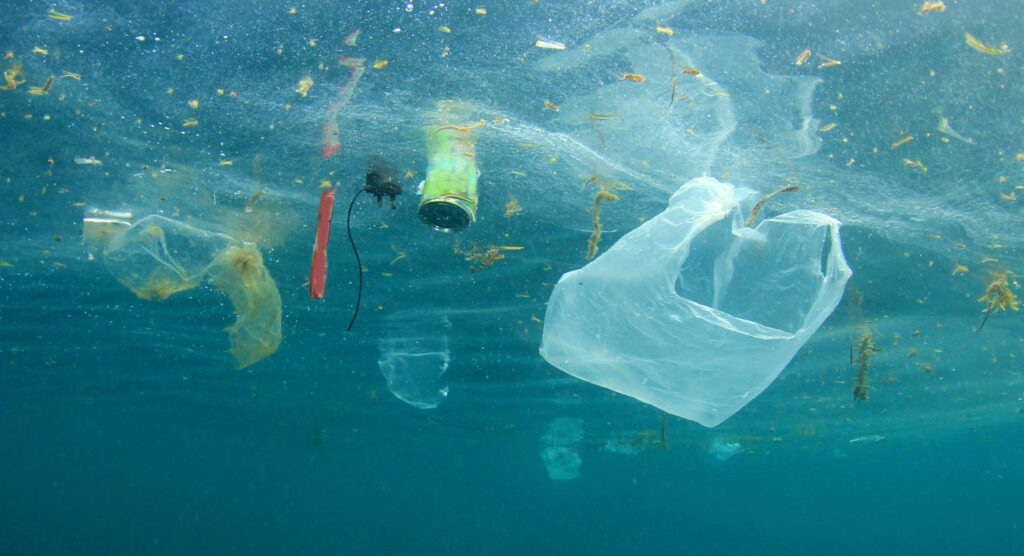
The ocean occupies an area of 70% on the earth. It can be calm, jubilant, or furious. In this vast ocean world, some foreign objects seriously threaten the survival of marine life.
A report released by the World Economic Forum in 2016 showed thatEvery year, 8 million tons of plastic enter the ocean.This is equivalent to one truckload of plastic being dumped into the ocean every minute.
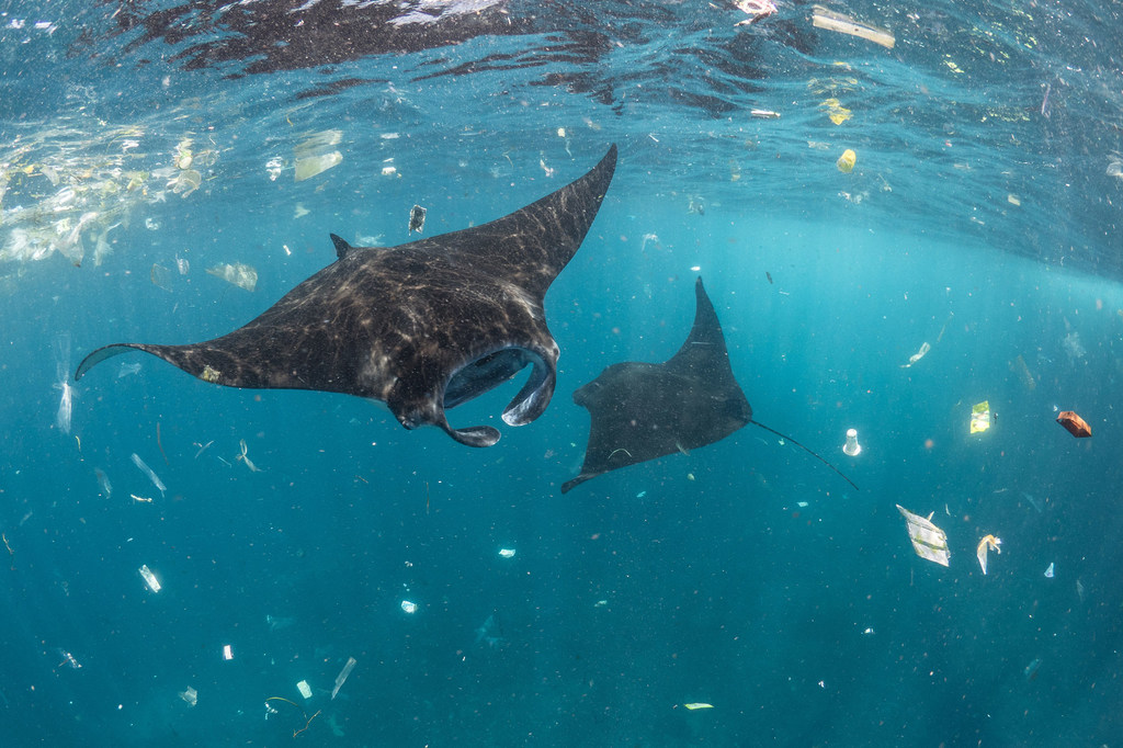
There are more than 800 species of coastal and marine life directly affected by plastic waste, and every year 1 million seabirds and 100,000 marine mammals die from plastic waste.
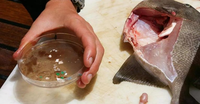
Plastic pollution in the ocean also threatens human health.When difficult-to-degrade plastic waste enters the sea, it will turn into microplastics under the action of external forces and can easily be eaten as food by fish, shellfish and other creatures.
Plastic toxins will eventually reach human dining tables through fish, shrimp, and shellfish. Some experts even suggest thatPlastics in the ocean will eventually break down into nanoplastics, which are so small that they can enter human cells if ingested.Affects human hormone levels and growth and development.
The United Nations Environment Programme pointed out in a report that among the plastic waste dumped into the ocean,95% comes from 10 rivers and 60% comes from Southeast Asia, with the Mekong River being the most polluted.
UN Deputy Secretary-General Armida said
ASEAN is the region with the worst marine plastic pollution in the world
The Mekong River is the most important transnational water system in Southeast Asia, flowing through six countries and providing drinking water for 70 million people along the way.How to solve the plastic pollution in the Mekong River has become an important issue concerning all mankind and its future generations.
CounterMEASURE: Finding the gateway to plastic pollution
In May 2019, the United Nations Environment Programme launched a countermeasure project against plastic pollution in the Mekong and Ganges rivers, code-named CounterMEASURE.
CounterMEASURE focuses on the “entry point” of plastic waste in the ocean, that is, how the waste enters the seawater. One of its important purposes is toIt is to develop an identification and monitoring model to pinpoint the sources and pathways of plastic waste in the Mekong River Basin.
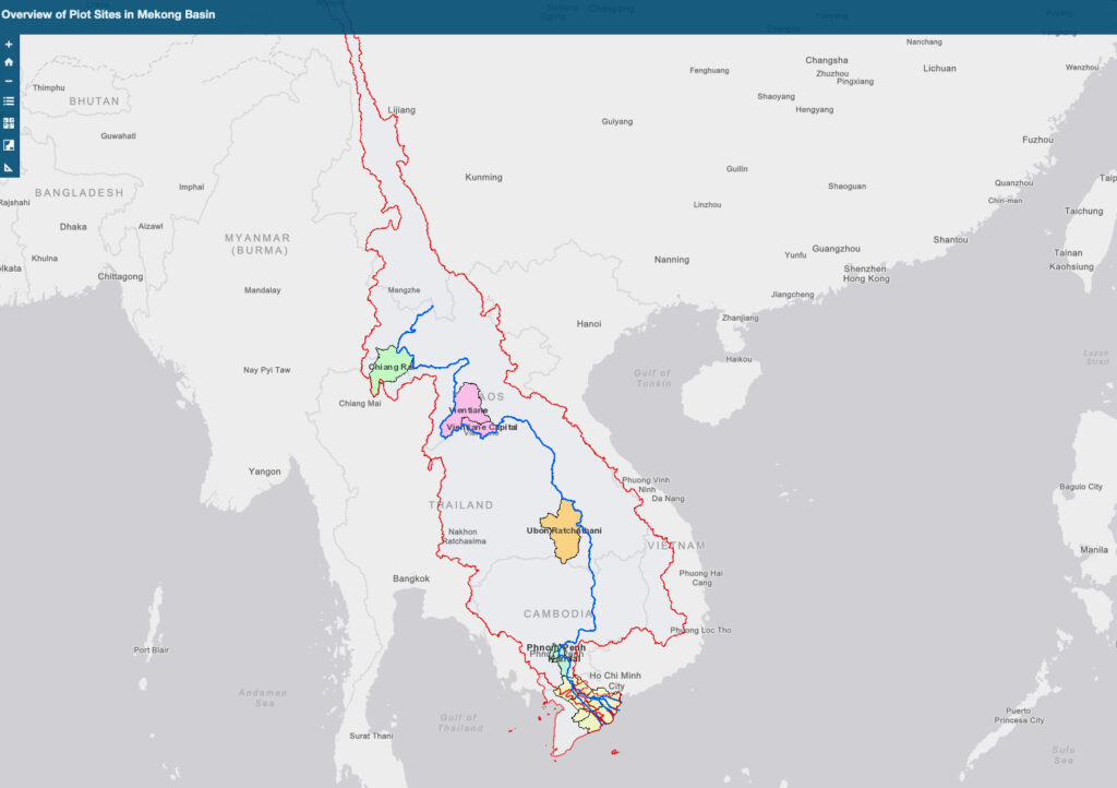
The blue line represents the Mekong River, and the red circle represents the Mekong River basin
Three of the pilot projects are located in Singapore, Vietnam and Cambodia.
2 pilot sites are located in Thailand
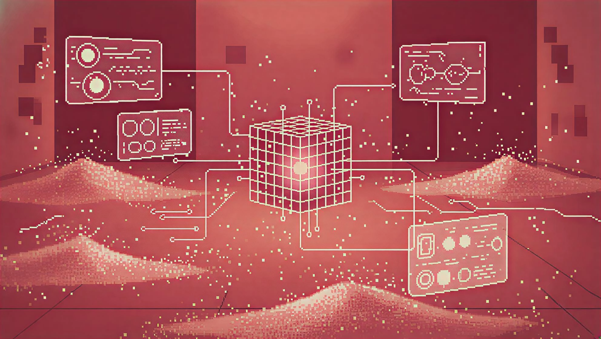
In the project, scientists used technologies such as drones, GIS and machine learning to monitor rivers, waterways and other land areas that ultimately flow into the ocean, obtain geospatial data and images of plastic waste, and based on this developed cutting-edge technology that can assess plastic pollution in the Mekong River.
GIS + UAV + ML, one-stop sampling and analysis
With the support of the Geographic Information Center (GIC) of the Asian Institute of Technology, researchers developed a GIS platform toThe aim is to use drones to take aerial images of the Mekong River basin and calculate the actual distribution and emissions of plastic waste based on the images.
- Aerial Photography
Machine Model:DJI Phantom 4 Pro
Shooting range:Mekong River Basin and its tributaries in Ubon Ratchathani, Thailand and Vientiane, Laos
Shooting requirements:The shooting standard in Laos is less than or equal to 30m above sea level, with a resolution of 4K (3840×2160 pixels), and 623 optical images were used for analysis.
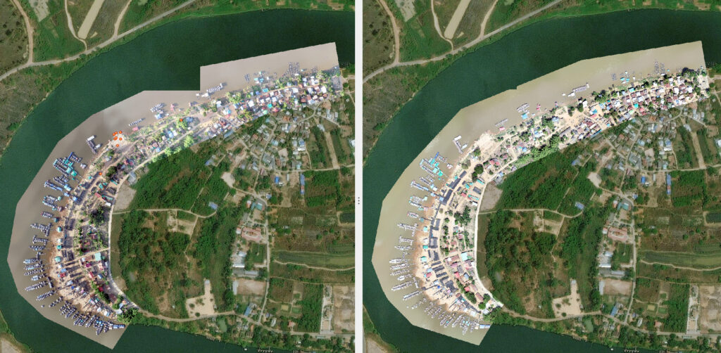
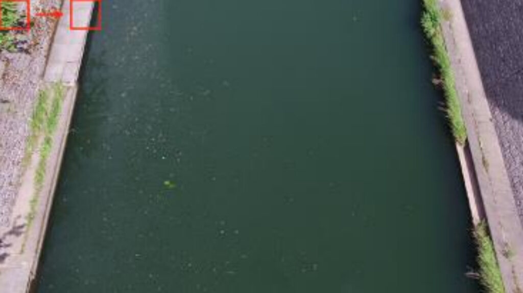
The left and right pictures show the comparison before and after garbage cleaning
- Step 1: Create a dataset
Aerial images of Laos.A total of 3423 images containing garbage and 7000 images not containing garbage are included.And use this as the data set for model training.

- Step 2: Create an object detection model
The aerial images collected by the drone are evenly divided according to the aspect ratio.Then use the slide window method to perform deep learning on each area.
Analyze the entire image by sliding a rectangle with a fixed width
This method makes it easier to verify the analysis results
And it has advantages in the detection and identification of small-volume garbage
In this process,You only need to determine 3 parameters: the length and width of the rectangle and the width of the slide.This makes the process faster and more intuitive.
The deep learning model used in this stage isIt is created based on three existing CNN system models (VGG16, MobileNet-V2, Inception-v3).
During model creation,With the help of Google Vision API, 1098 garbage areas can be detected.
- Experimental Results
Image analysis results show:A total of 8284 pieces of trash were found in the Mekong River basin of 761,400 square meters in Vientiane, Laos (excluding image overlap areas), with an average of 10.89 pieces of trash per 1000 square meters.
In addition, by using the transfer learning method, the target objects are divided into multiple categories or multiple inputs are used.The accuracy of the model can be further improved.
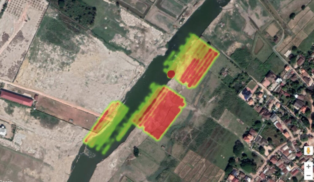
Red indicates a large amount of paper waste, while green indicates a small amount of waste
There is still a long way to go to build a universal model
The plastic waste identification model for the Mekong River Basin in Vientiane, Laos, has an accuracy rate of 83.9%.However, this model is only applicable to the Mekong River Basin in Vientiane and is not universal.
Data released by the United Nations Environment Programme shows that 95% of global marine plastic pollution comes from 10 rivers, eight of which are in Asia and two in Africa.
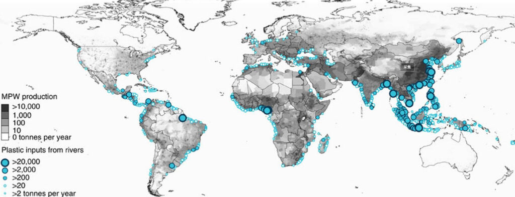
The 10 rivers are the Mekong, Indus, Ganges, Nile and Niger.
Amur River, Yangtze River, Yellow River, Haihe River, Pearl River
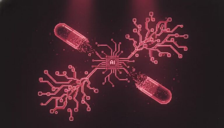
Create a common machine learning model for different rivers, unify aerial photography standards and image formats,It is the key to expanding the scope of the investigation and controlling the amount of plastic waste entering the sea as soon as possible.
On April 20, the United Nations Environment Programme announced thatWill work with Google to develop general machine learning models for ocean plastic pollution.
This new general machine learning model can not only provide a more detailed and accurate analysis of plastic pollution in the Mekong River basin,It will also be highly scalable and usable, applicable to other heavily plastic-polluted river basins in the world, and provide material for the development of heat maps of the spread of plastic pollution.
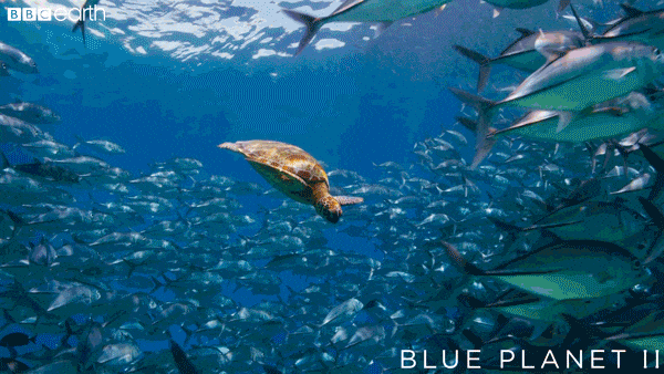
The health of the ocean is closely related to the earth and human life. In the classic BBC documentary "Blue Planet", it was said:
The ocean is limitless and fills us with awe, wonder and sometimes fear.
Perhaps what humans lack today is this kind of awe and love. As the rivers flow into the sea, if you and I reduce the use of plastic products, we can protect the marine ecology from the source.