Command Palette
Search for a command to run...
FLAIR HUB Multi-sensor French Land Dataset
Date
Size
Paper URL
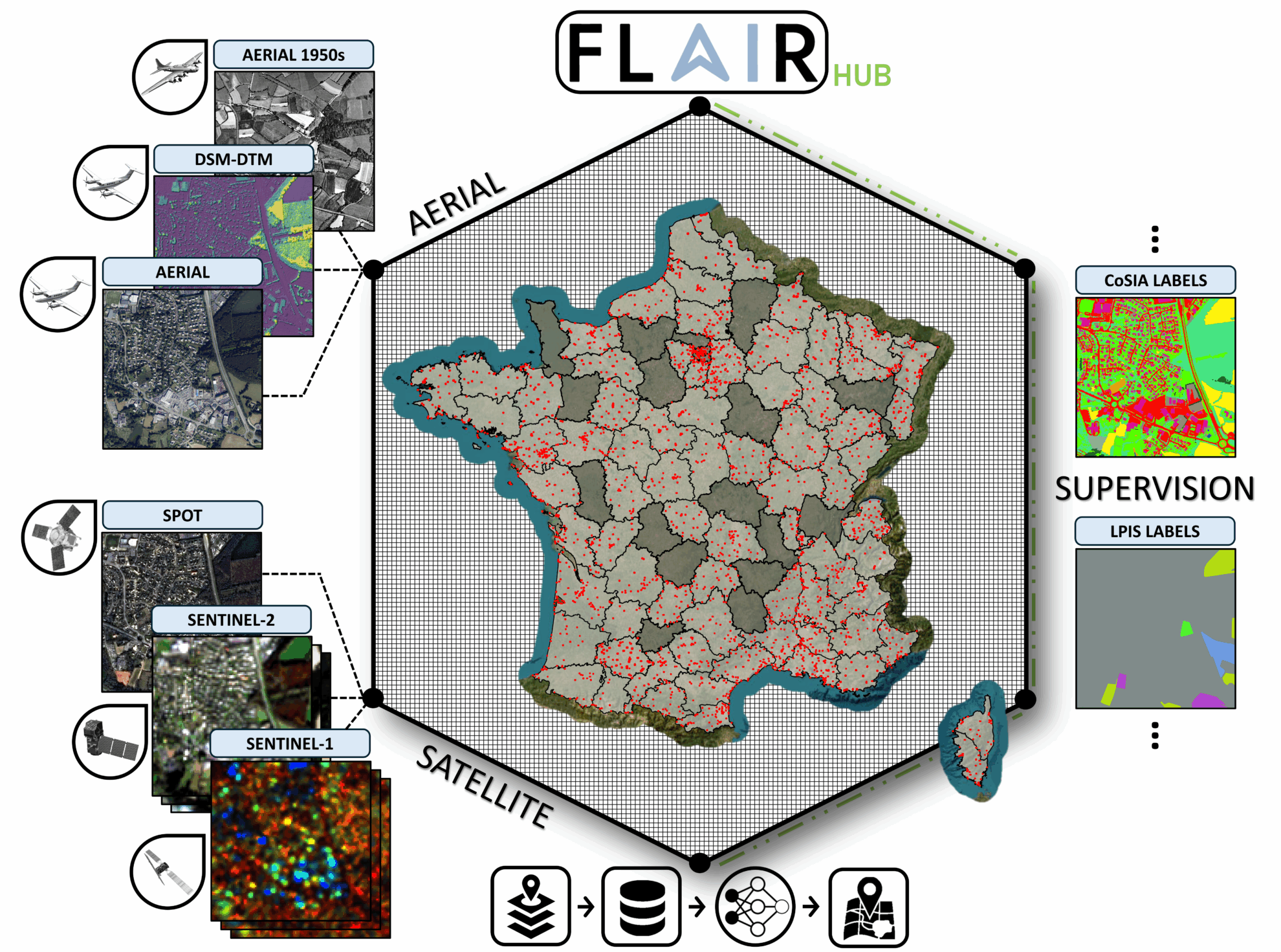
FLAIR-HUB is a large-scale multi-sensor land cover dataset. The related paper results are:FLAIR-HUB: Large-scale Multimodal Dataset for Land Cover and Crop Mapping", which aims to provide comprehensive and high-resolution multimodal annotation data for multiple fields such as land cover classification, agricultural monitoring, and ecological and environmental assessment.
The dataset covers more than 2,500 square kilometers of France's diverse eco-climates and landscapes, 19 land cover classes and 23 crop classes, contains 63 billion manually annotated pixels, and integrates complementary data sources, including aerial imagery, SPOT and Sentinel satellite data, surface models, and historical aerial photographs. It provides rich spatial, spectral, and temporal diversity, and supports the development of semantic segmentation, multimodal fusion, and self-supervised learning methods.
 Data Types
Citation
@article{GARIOUD2026271, title = {FLAIR-HUB: Large-scale multimodal dataset for land cover and crop mapping}, author = {Anatol Garioud and Sébastien Giordano and Nicolas David and Nicolas Gonthier}, journal = {ISPRS Journal of Photogrammetry and Remote Sensing}, volume = {237}, pages = {271-300}, year = {2026}, issn = {0924-2716}, doi = {https://doi.org/10.1016/j.isprsjprs.2026.04.017}, url = {https://www.sciencedirect.com/science/article/pii/S0924271626001899}, }
Build AI with AI
From idea to launch — accelerate your AI development with free AI co-coding, out-of-the-box environment and best price of GPUs.