Command Palette
Search for a command to run...
RIT-18 Remote Sensing Image Semantic Segmentation Dataset
Date
Publish URL
Paper URL
License
Other
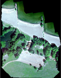
RIT-18 is a dataset for semantic segmentation of remote sensing images. The dataset was collected by a Tetracam Micro-MCA6 multispectral imaging sensor mounted on a DJI-1000 octorotor. The characteristics of this dataset include
- Ultra-high-resolution multispectral imagery from drones
- Six spectral VNIR bands
- Contains a severely imbalanced class distribution, involving 18 object classes (plus background).
Citation
@article{kemker2018algorithms, title = “Algorithms for semantic segmentation of multispectral remote sensing imagery using deep learning”, journal = “ISPRS Journal of Photogrammetry and Remote Sensing”, year = “2018”, issn = “0924-2716”, doi = “https://doi.org/10.1016/j.isprsjprs.2018.04.014”, url = “http://www.sciencedirect.com/science/article/pii/S0924271618301229”, author = “Ronald Kemker and Carl Salvaggio and Christopher Kanan”, }
Build AI with AI
From idea to launch — accelerate your AI development with free AI co-coding, out-of-the-box environment and best price of GPUs.