Command Palette
Search for a command to run...
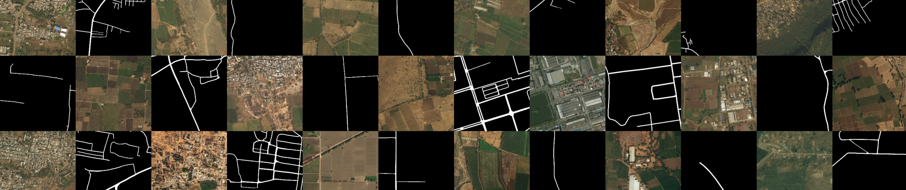
DeepGlobe 18 Road Extraction Dataset
 In disaster-affected areas, especially in developing countries, maps and accessibility information are critical for crisis response. DeepGlobe Road Extraction ChallengeThe challenge of automatically extracting road and street networks from satellite imagery is presented.
The training data for the Road Challenge contains 6,226 RGB satellite images of size 1024 × 1024. The images have a resolution of 50 cm pixels and are collected by DigitalGlobe's satellites. The dataset contains 1,243 validation images and 1,101 test images (but without masks).
In disaster-affected areas, especially in developing countries, maps and accessibility information are critical for crisis response. DeepGlobe Road Extraction ChallengeThe challenge of automatically extracting road and street networks from satellite imagery is presented.
The training data for the Road Challenge contains 6,226 RGB satellite images of size 1024 × 1024. The images have a resolution of 50 cm pixels and are collected by DigitalGlobe's satellites. The dataset contains 1,243 validation images and 1,101 test images (but without masks).
Label
- Each satellite image is accompanied by a mask image that is used to mark roads. The mask is a grayscale image with white representing road pixels and black representing the background.
- The file names of the satellite images and the corresponding mask images are id _sat.jpg and id _mask.png .id yesA random integer.
- Please note:
- The values of the mask image may not be pure 0 and 255. Please perform binarization at a threshold of 128 when converting it into a label.
- The labels are not perfect due to the high cost of annotating segmentation masks, especially in rural areas. In addition, we intentionally do not annotate paths within farmland.
Acknowledgements
The dataset comes from DeepGlobe Challenge InRoad Extraction Challenge Track.
Build AI with AI
From idea to launch — accelerate your AI development with free AI co-coding, out-of-the-box environment and best price of GPUs.