Command Palette
Search for a command to run...
AdaTreeFormer-Jiangsu Jiangsu high-resolution Tree Detection Dataset
Date
Size
Publish URL
Paper URL
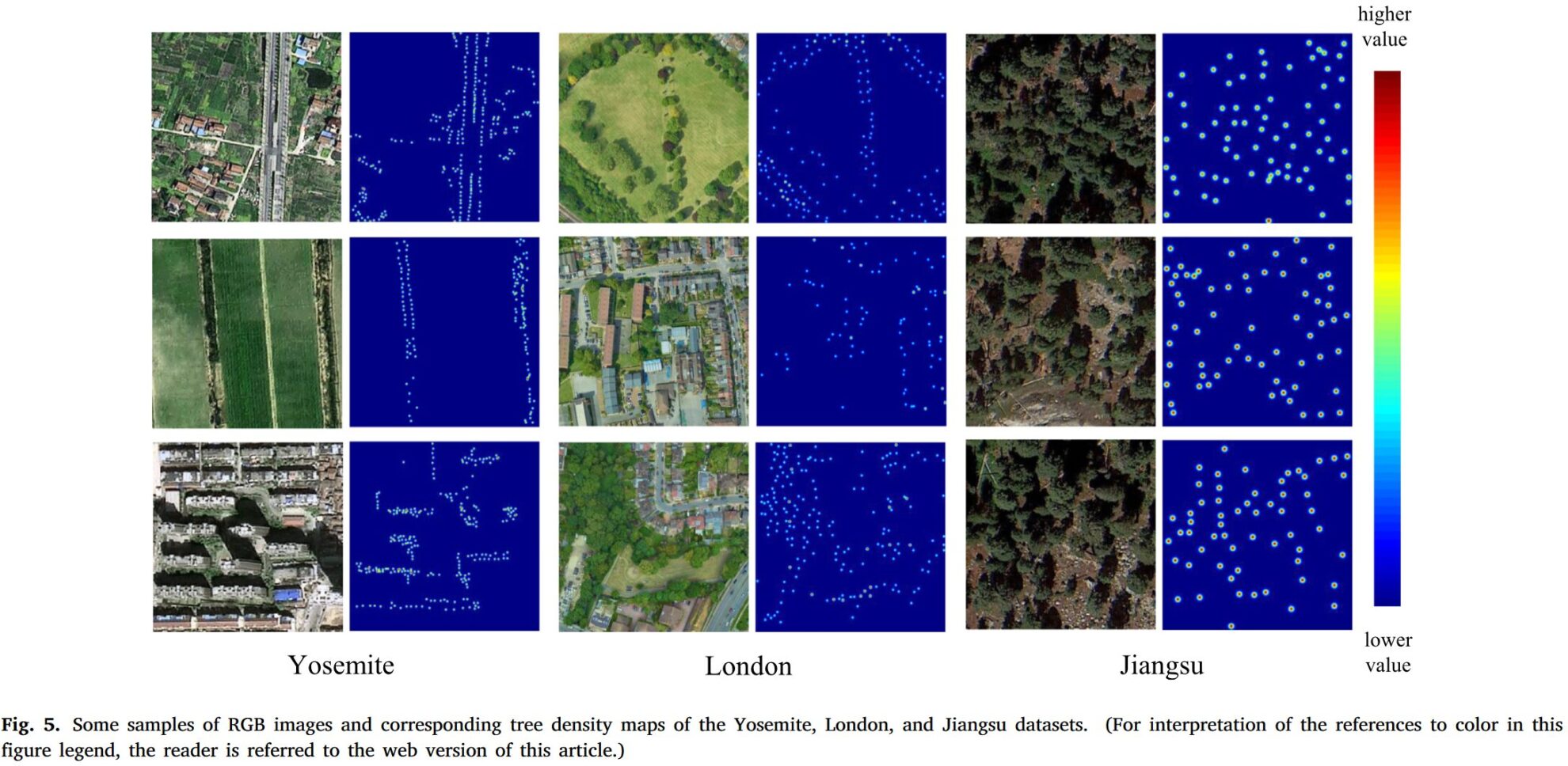
This dataset is a high-resolution tree counting and localization dataset in plain and hilly areas of eastern China. Tongji University and King's College London published a paper titled "AdaTreeFormer: Few shot domain adaptation for tree counting from a single high-resolution image"This paper was accepted by "ISPRS Journal of Photogrammetry and Remote Sensing". The paper used three datasets: London dataset, Jiangsu dataset and Yosemite dataset. This dataset provides a high-resolution tree detection dataset in Jiangsu.
- Location: Jiangsu Province, China
- Landscape types: farmland, suburban, urban, residential
- Average number of trees per image: 276
- Total number of trees: 664,487
- Image resolution: 0.8 meters
- Data division: training set: 1920 images, test set: 480 images The Jiangsu dataset includes a variety of landscape types, such as farmland and suburbs, with relatively high tree density. This diversity provides good testing conditions for the adaptability of the model in different environments.
Dataset background
Trees are central organisms that maintain global biodiversity and the health of the Earth. They contribute extensively to biogeochemical cycles and provide countless ecosystem services, including water quality control, wood reserves, and carbon sequestration. Tree density is an important component of ecosystem structure, controlling the rates of element processing and retention, as well as the suitability of habitats for many plant and animal species. The number of trees in a particular area can also serve as an important indicator to guide forest management practices and provide reference for public and government decision-making. However, due to the complex distribution of trees, it has been a challenge to efficiently and effectively obtain the number of trees at a larger spatial scale using remote sensing technology. In order to meet the growing demand for single tree scale research, we produced a tree counting dataset based on GF-Ⅱ remote sensing images with a spatial resolution of 0.8m. The dataset contains 2,400 samples in different geological scenarios in temperate and subtropical plains and hills, including wild woodlands, urban and rural areas. Each sample pair consists of a remote sensing image, tree annotation, and a tree density map generated by Gaussian convolution. Cross-validation experiments show that the determination coefficient (R) between the ground truth and the estimated value of the common counting network is 2) can achieve competitive performance (above 0.93) and an average accuracy greater than 84%. This dataset can be used for tree density estimation, tree counting, and tree location studies, thereby facilitating biological analysis and promoting model development for tasks that rely on predictions of individual trees.
Build AI with AI
From idea to launch — accelerate your AI development with free AI co-coding, out-of-the-box environment and best price of GPUs.