HyperAI
Command Palette
Search for a command to run...
Earth Parser Dataset Remote Sensing Mapping Dataset
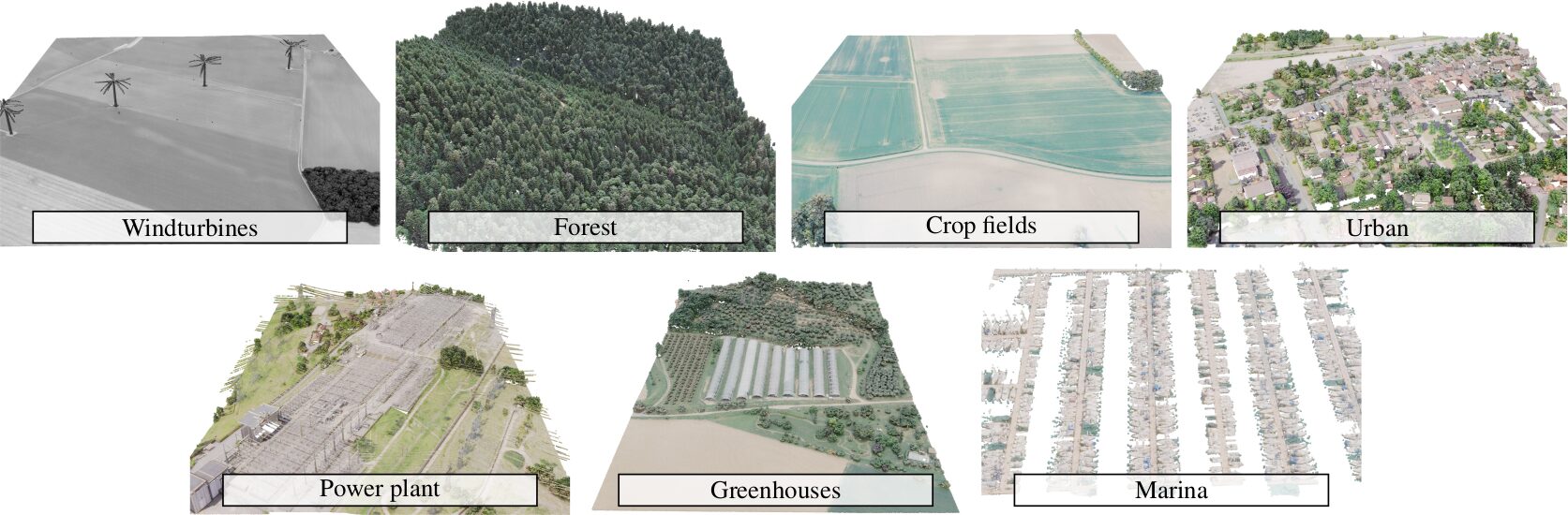
The dataset is a new dataset for training and evaluating interpretation methods for large, uncurated aerial LiDAR scans. The research team used data from the French Survey and Mapping Agency associated with the LiDAR-HD project. The dataset contains 7 scenes covering more than 7.7 square kilometers and a total of 98 million 3D points, with different content and complexity, such as densely populated areas, forests, or complex industrial facilities. This dataset is in the paperLearnable Earth Parser: Discovering 3D Prototypes in Aerial Scans", which has been accepted by CVPR 2024.
EarthParserDataset.torrent
Seeding 1Downloading 0Completed 181Total Downloads 257
This dataset is contributed by community users and is intended for educational and informational purposes only. If any content involves copyright infringement, please contact us at [email protected] for prompt review and removal.
Build AI with AI
From idea to launch — accelerate your AI development with free AI co-coding, out-of-the-box environment and best price of GPUs.
AI Co-coding
Ready-to-use GPUs
Best Pricing
HyperAI Newsletters
Subscribe to our latest updates
We will deliver the latest updates of the week to your inbox at nine o'clock every Monday morning
Powered by MailChimp