Command Palette
Search for a command to run...
LoveDA: A Remote Sensing Land Cover Dataset for domain-adaptive Semantic Segmentation
Date
Size
Publish URL
Paper URL

The LoveDA dataset is a land cover dataset for remote sensing, designed specifically for domain adaptive semantic segmentation. It was built by the RSIDEA team of the State Key Laboratory of Surveying, Mapping and Remote Sensing Information Engineering at Wuhan University, and aims to promote research on semantic segmentation and transfer learning in remote sensing. Here are some key features of the LoveDA dataset:
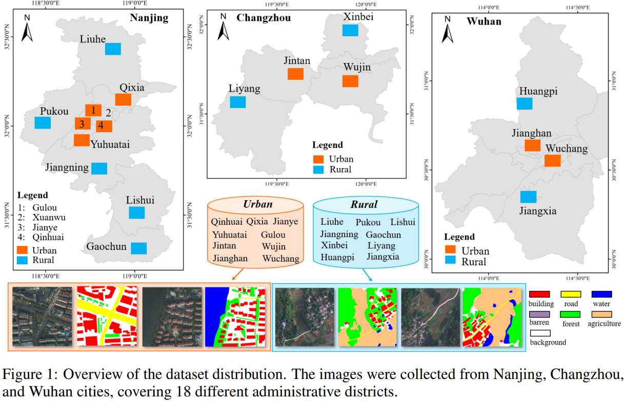
- Multi-scale objects: The high spatial resolution (HSR) images in the dataset are collected from 18 complex urban and rural scenes in three different cities in China. Objects of the same category in these scenes present completely different scale changes in different geographical landscapes.
- Complex background samples: The LoveDA dataset contains rich details and larger intra-class variations, especially background samples, which increases the complexity of the classification task.
- Inconsistent category distribution: There are differences in category distribution between urban and rural scenes. Urban scenes contain more man-made objects, such as buildings and roads, while rural scenes contain more natural elements, such as water bodies and forests.
- applicability:This dataset is suitable for both the semantic segmentation task of land cover and the unsupervised domain adaptation (UDA) task, providing researchers with new challenges and research directions.
- Large-scale annotation: The LoveDA dataset contains 5,987 high-resolution images and 166,768 annotated semantic objects, making it one of the largest datasets of its kind.
- Data Source: The images in the dataset are from the Google Earth platform and collected from Nanjing, Changzhou and Wuhan, covering a total area of 536.15 square kilometers.
- Open Source: The LoveDA dataset is free and open source, and the relevant code and data can be found on GitHub, promoting research and collaboration within the community.
- Social Impact: This dataset was developed to advance land cover mapping technology in the field of remote sensing and may have positive impacts on society, such as reducing the human and material resources required for field mapping.
The release of the LoveDA dataset provides a challenging data resource for researchers in the remote sensing field to solve practical problems and promote the development of related technologies.
Build AI with AI
From idea to launch — accelerate your AI development with free AI co-coding, out-of-the-box environment and best price of GPUs.