Command Palette
Search for a command to run...
SensatUrban city-scale Point Cloud Dataset
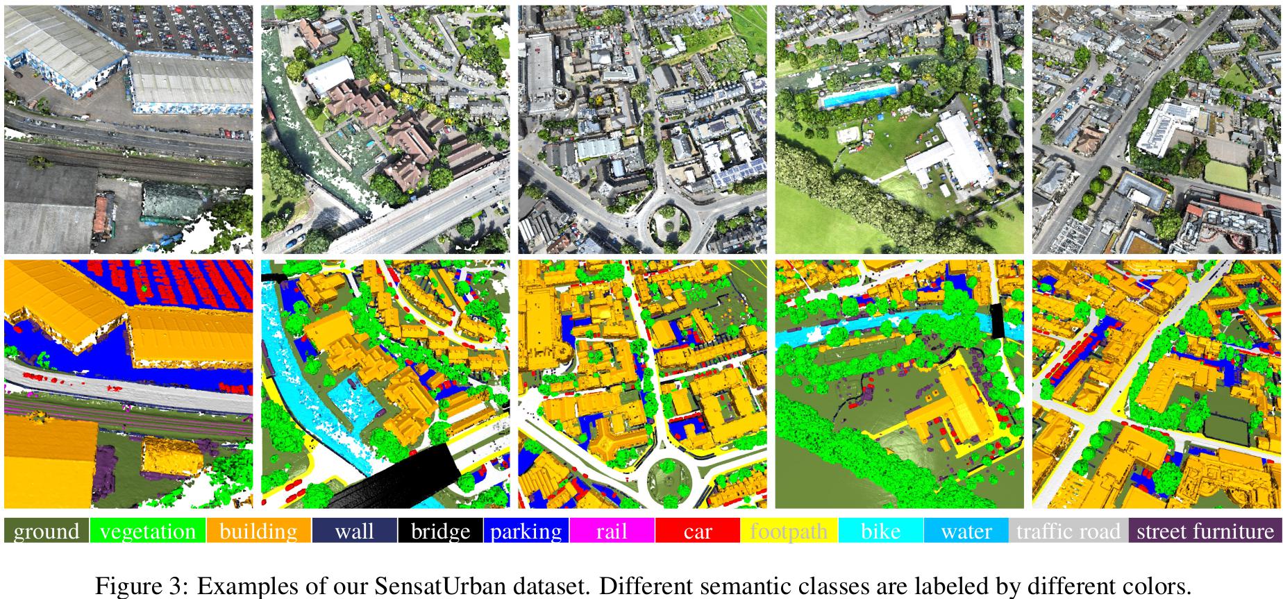
SensatUrban is a city-scale photogrammetric point cloud dataset. The dataset selects 7.6 square kilometers of three British cities (Birmingham, Cambridge and York) and annotates nearly 3 billion semantically labeled points. Each point in the dataset is labeled as one of 13 semantic categories, such as ground, vegetation, cars, etc.
Citation
If you find our work useful in your research, please consider citing: @inproceedings{hu2020towards, title={Towards Semantic Segmentation of Urban-Scale 3D Point Clouds: A Dataset, Benchmarks and Challenges}, author={Hu, Qingyong and Yang, Bo and Khalid, Sheikh and Xiao, Wen and Trigoni, Niki and Markham, Andrew}, booktitle={Proceedings of the IEEE/CVF Conference on Computer Vision and Pattern Recognition}, year={2021} } @article{hu2022sensaturban, title={Sensaturban: Learning semantics from urban-scale photogrammetric point clouds}, author={Hu, Qingyong and Yang, Bo and Khalid, Sheikh and Xiao, Wen and Trigoni, Niki and Markham, Andrew}, journal={International Journal of Computer Vision}, volume={130}, number={2}, pages={316–343}, year={2022}, publisher={Springer} }
Build AI with AI
From idea to launch — accelerate your AI development with free AI co-coding, out-of-the-box environment and best price of GPUs.