Command Palette
Search for a command to run...
Ecomapper Satellite Imagery Dataset
Date
Organization
Publish URL
Paper URL
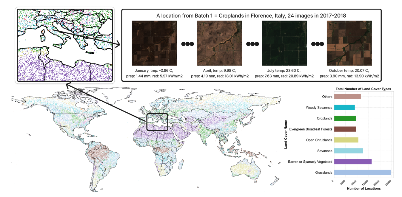
The EcoMapper dataset is a satellite image dataset released in 2025 by the Technical University of Munich in Germany and the University of Zurich in Switzerland. The relevant paper results are:EcoMapper: Generative Modeling for Climate-Aware Satellite Imagery", has been selected for ICML 2025.
The dataset contains more than 2.9 million satellite images, including RGB images and specific multispectral channel data (B6 – Red Edge 2, B8 – Near Infrared, B11 – Short Wave Infrared 1). The data images are from the Copernicus Sentinel satellite mission, covering a variety of land cover types and multiple time points. The training set has 98,930 different geographic locations, each with 24 months of data; the test set contains 5,494 locations, with data covering 96 months. Each timestamp of each image is accompanied by relevant weather metadata, such as temperature, solar radiation, and precipitation information.
 Dataset Example
Build AI with AI
From idea to launch — accelerate your AI development with free AI co-coding, out-of-the-box environment and best price of GPUs.