HyperAI
Command Palette
Search for a command to run...
SkyCity Aerial City Landscape City Landscape Aerial Dataset
Date
a year ago
Size
117.1 MB
Organization
Publish URL
* This dataset supports online use.Click here to jump.
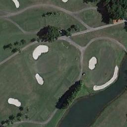
This dataset is a curated dataset for aerial landscape classification, with a total of 8k images, 10 different categories, each category contains 800 high-quality images, and the resolution is 256 × 256 pixels. This dataset brings together urban landscapes from the public AID and NWPU-Resisc45 datasets, aiming to facilitate urban landscape analysis.
The categories included in the dataset are: bridges, commercial places, industrial places, intersections, landmarks, parks, parking lots, playgrounds, residences, and stadiums.
skycity-the-city-landscape-dataset.torrent
Seeding 2Downloading 0Completed 194Total Downloads 570
This dataset is contributed by community users and is intended for educational and informational purposes only. If any content involves copyright infringement, please contact us at [email protected] for prompt review and removal.
Build AI with AI
From idea to launch — accelerate your AI development with free AI co-coding, out-of-the-box environment and best price of GPUs.
AI Co-coding
Ready-to-use GPUs
Best Pricing
HyperAI Newsletters
Subscribe to our latest updates
We will deliver the latest updates of the week to your inbox at nine o'clock every Monday morning
Powered by MailChimp