HyperAI
Command Palette
Search for a command to run...
EuroSAT Remote Sensing Image Dataset
Date
3 years ago
Size
2.01 GB
Publish URL
Paper URL
License
Other
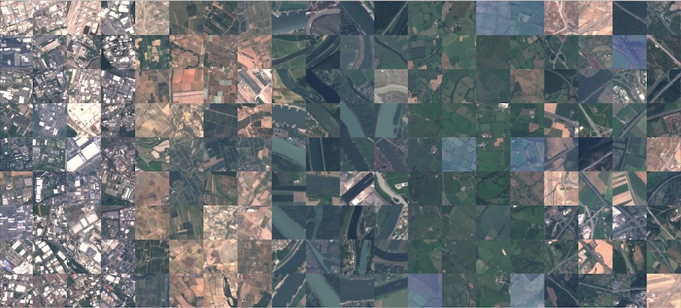
Eurosat is a dataset and deep learning benchmark for land use and land cover classification. The dataset is based on Sentinel-2 satellite images, covers 13 spectral bands, consists of 10 categories, and has a total of 27,000 annotated and georeferenced images. Each scene category contains 2,000 to 3,000 remote sensing images, each with a size of 64 × 64 pixels. The dataset contains the following 10 categories:
- Industrial Buildings
- Residential Buildings
- Annual Crop
- Permanent Crop
- River
- Sea & Lake
- Herbaceous Vegetation
- Highway
- Pasture
- Forest
Citation
@article{helber2019eurosat,
title={Eurosat: A novel dataset and deep learning benchmark for land use and land cover classification},
author={Helber, Patrick and Bischke, Benjamin and Dengel, Andreas and Borth, Damian},
journal={IEEE Journal of Selected Topics in Applied Earth Observations and Remote Sensing},
year={2019},
publisher={IEEE}
}
EuroSAT.torrent
Seeding 1Downloading 0Completed 986Total Downloads 1,430
This dataset is contributed by community users and is intended for educational and informational purposes only. If any content involves copyright infringement, please contact us at [email protected] for prompt review and removal.
Build AI with AI
From idea to launch — accelerate your AI development with free AI co-coding, out-of-the-box environment and best price of GPUs.
AI Co-coding
Ready-to-use GPUs
Best Pricing
HyperAI Newsletters
Subscribe to our latest updates
We will deliver the latest updates of the week to your inbox at nine o'clock every Monday morning
Powered by MailChimp